

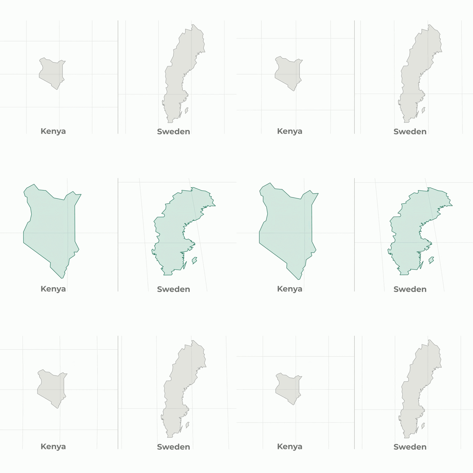
Kathmandu— The United Nations General Assembly voted 164 to 1 to adopt a resolution promoting the Equal Earth projection as an alternative to the Mercator map, which has long distorted the relative sizes of continents, particularly underestimating Africa. The move aims to correct centuries-old cartographic inaccuracies that have influenced education and global perceptions.
Historical Context of Map Distortions
The Mercator projection, designed in the 16th century for European maritime exploration, has long been criticized for its distortions. This map projection inflates the size of regions near the poles, such as Europe and North America, while minimizing the size of equatorial regions like Africa, Latin America, and South Asia. The distortion is particularly pronounced, making Greenland appear roughly the same size as Africa, which is actually about 14 times larger.
UNGA Resolution and Voting Dynamics
The United Nations General Assembly passed a resolution on Friday, with 164 countries in favor and only the United States opposing. The resolution encourages schools, institutions, and tech companies to adopt the Equal Earth projection, which preserves true area at the cost of slightly bending the outlines of continents. The African Group, led by Togo, played a key role in the push, with the African Union backing the initiative. The United States, represented by Yaryna Ferencevych, argued that the resolution was a 'radical ideological project' and that the UN was 'debating map projects from the 16th century.'
Implementation and Future Plans
The African Union adopted the Equal Earth projection in March and is planning a meeting in Lomé early next year, involving UNESCO, the African Union, and technology companies like Google, to work out practical implementation. The UN stated that the resolution is nonbinding and does not ban the Mercator projection, but encourages its replacement with the Equal Earth projection. This move aims to correct the long-standing distortions in global education and collective perception.
The adoption of the Equal Earth projection marks a significant step in addressing historical map distortions and promoting more accurate global education.
(With inputs from Al Jazeera)
More from the source

Originally published on abcnews.com.np.






प्रतिक्रिया दिनुहोस्